- Is the Intracoastal Waterway man-made?
- Florida’s Intracoastal Waterway is comprised of natural inlets and saltwater rivers as well as bays, man-made waterways, and canal systems.
- How long does it take to navigate the Intracoastal Waterway?
- The Intracoastal Waterway is a beautiful way to see our country and some of the most iconic areas. The waterway itself can take about 4 weeks, but if you’re willing for an adventure on land as well then your trip will be much more enjoyable!
- Are there alligators in the Intracoastal Waterway in Florida?
- Yes!
- Are there sharks in the Intracoastal Waterway in Florida?
- Yes!
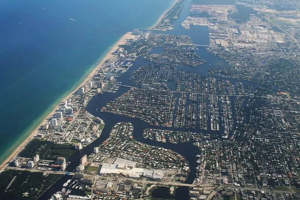
Intracoastal Waterway Florida is made up of natural inlets, saltwater rivers, bays, man-made waterways, and canal systems all interconnected to one another for your pleasure! It runs along the eastern and southern coasts of the U.S. state of Florida.
Developed in 1919, the Intracoastal Waterway was designed to make cruising easier for a variety of boats. The waterway is over 3,000 miles long and is used for both commercial and recreational purposes.
It is also home to a variety of plant and animal life.
It consists of a series of canals and bridges that allow boats to travel from one body of water to another without having to go out into the open ocean. The waterway spans from Boston, Massachusetts to Brownsville, Texas, and is used by both recreational and commercial vessels.
If you are planning a cruise down the Intracoastal Waterway in Florida, you may be wondering how to find the best ports.
There are six bridge types along the Intracoastal Waterway:
- Fixed bridges
- Lift bridges
- Single-bascule
- Swing bridges
- Double-pivot swinging
- Single-pivot swinging bridges
All of these types of bridges require the vessel to be raised to allow passage.
Different types of Navigational Aids on the Intracoastal Waterway of Florida.
Some are illuminated while others are not.
Red buoys are required to be maintained on starboard when approaching from the sea, while green buoys must be maintained on the port side when returning.
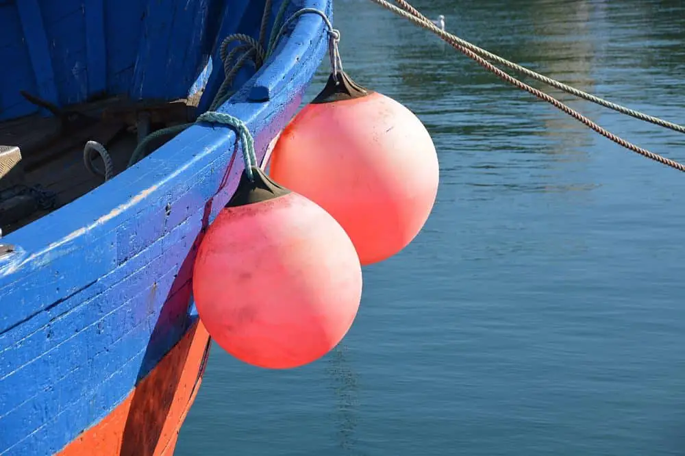
The color of the buoys indicates their lateral significance: green lights are brighter than red, and they are generally located in shoaling areas.
In addition to marking the channels, navigational aids must also mark any obstructions. It is illegal to destroy or damage these aids. Be sure to never tie a boat to a buoy, day beacon, or light structure, and always report intentional collisions with them.
The best way to avoid this type of collision is to follow the rules and regulations that apply to all types of navigational aids on the Intracoastal Waterway.
The most common type of navigational aid on the Intracoastal Waterway is a day board.
These are floating structures that indicate your position and can be easily identified.
These are the nautical equivalent of “You Are Here” markers. To determine your exact location, you must consult the appropriate nautical chart.
The only exception to this rule is the lighted day board, which is used on many rivers and lakes throughout the country.
The best way to navigate the Intracoastal Waterway is by using charts and good communication skills. Navigational aids for Intracoastal waterway Florida are made available by the National Oceanic and Atmospheric Administration (NOAA).
You can also buy water-resistant charts on Amazon.
You can even laminate these charts. They are a great way to avoid shallow or deep water.
You should use the yellow buoys and markers along the Intracoastal Waterway in Florida.
These buoys and markers are part of the U.S. Aids to Navigation System and are used by boaters and fishing vessels alike to locate the best way to navigate a passage through the Intracoastal Waterway.
However, it is important to know which buoys are marked by a yellow symbol.
You can also use yellow triangles and squares to identify river channel crossings.
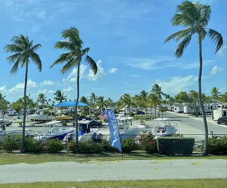
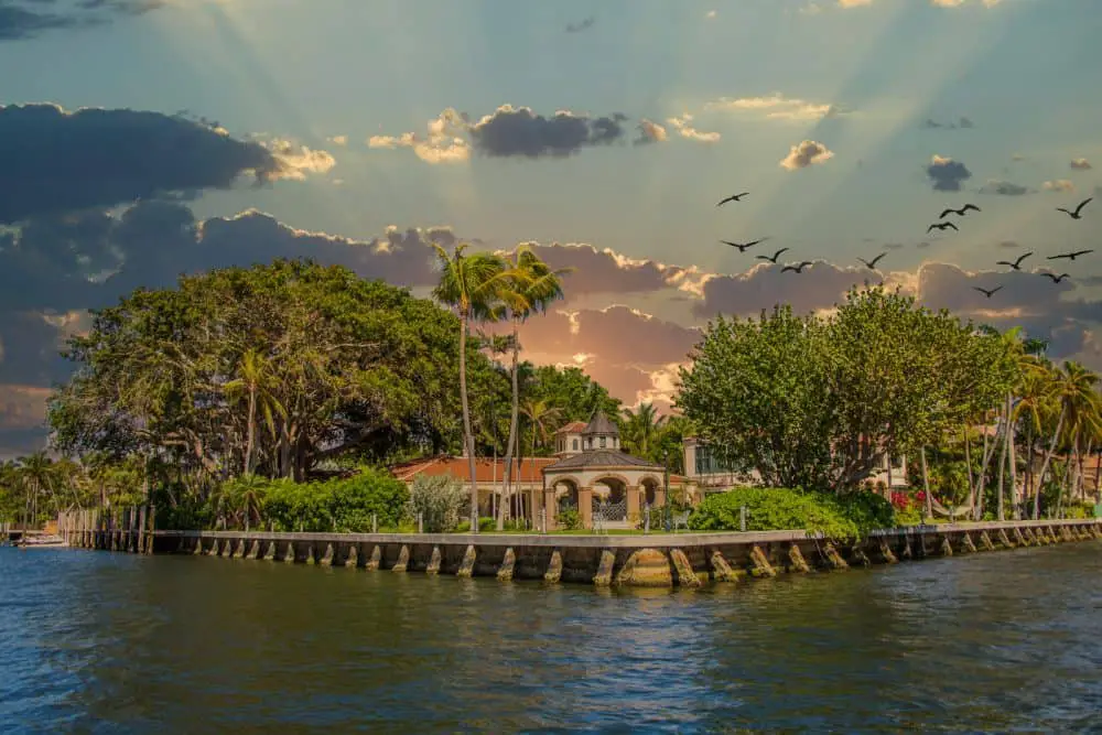
Ports of call along the Intracoastal Waterway of Florida
The most popular ports and anchorages are highlighted in Aerial Photography by Joseph R. Melanson. The guide includes full-page aerial photographs, and descriptions of marinas, resorts, shopping, diving, fishing, and more.
The guide also contains detailed information about the best ways to experience Florida’s waters.
Ports and anchorages are also highlighted in a section dedicated to recreational activities.
The Atlantic Intracoastal Waterway begins near the St. Marys River on the Georgia-Florida state line and extends northwest. In the Miami area, the AICW takes on a southwesterly course and intersects the Government Cut, where a vessel can enter the city from the Port Everglades.
Port Everglades is a stop along the AICW for ships larger than 56 feet.
To navigate the Waterway, you should familiarize yourself with navigational aids and major communication channels. Dayboards are most frequently found along the Waterway and can be found on dolphins, single pilings, and larger piling structures.
Their placement has no significance, but they do help you avoid obstructions in your way.
The day boards are also shaped conventionally. Odd and even numbers are prominently displayed.
For cruisers interested in exploring Florida’s ports, the Atlantic Intracoastal Waterway (ICW) is a three-thousand-mile long inland waterway. Its navigability makes it the most popular boating route in the world.
The Intracoastal Waterway provides a safe and convenient route for ships. There are also many stops along the way to enjoy the beauty of Florida.
The Intracoastal Waterway is a protected, inland waterway extending from Massachusetts southward to Brownsville, TX. It was originally designed for shipping, but recreational boaters now use it as a highway.
The ICW features mile markers and passes through many interesting towns and ports. And because it’s not open to the ocean, navigating it can be quite safe.
While the Atlantic Intracoastal Waterway is a major shipping route, there are many smaller inland waterways and bays. In fact, the Atlantic Intracoastal has delivered more cruisers to the waters of their dreams than any other waterway in the country.
Commercial activity along the Intracoastal Waterway
The Intracoastal Waterway is a navigable toll-free shipping route that runs along the Atlantic Ocean and Gulf of Mexico coasts. It is a system of canals, lagoons, rivers, and sounds.
It is federally maintained and connected to other waterways in many places.
Originally planned as a continuous channel from New York City to Brownsville, Texas, the Intracoastal Waterway is now in two sections, Atlantic and Gulf.
The Intracoastal Waterway system includes natural bodies of water such as :
- Apalachicola Bay
- St. Andrews Bay
- Biscayne Bay
- Bogue Sound
The Gulf Intracoastal Waterway also includes:
- Charleston Harbor
- Delaware Bay
- the Gulf of Mexico
- Little River
- Mobile Bay
- Pensacola Bay
- Savannah Bay
Various industries use the waterway to facilitate trade and tourism.
The Intracoastal Waterway follows the shoreline closely, with numerous locks. Some vessels may encounter problems crossing power lines, as they cross Julia Tuttle Bridge, which has a fixed clearance of 56 feet.
In addition, vessels traveling southbound must exit the AICW around Port Everglades and reenter the channel after the Government Cut in Miami.
These obstructions can hinder vessel movement and reduce the economic benefits of the waterway.
The Marine Waterway Master Planning team has met with residents in the area three times to discuss its preliminary concepts and Inventory & Analysis. Residents provided important feedback regarding the project concepts and helped the team refine the menu of projects to meet community needs.
The final menu of project options was presented to the public in order to gain consensus.
It is a collaborative process between the State of Florida and local residents. In the end, we will develop a master plan that incorporates the community’s concerns.
What is the purpose of the Intercoastal waterway?
The Intracoastal Waterway was created in the early 1900s as a way to transport goods between coastal cities without having to rely on ships that could be easily lost in storms or attacked by pirates.
Today, its primary function is to serve as a navigable route by which maritime traffic can avoid going around Hurricane Alley.
The waterway is used for recreation, transportation, and even as a source of drinking water for some areas. It is also an important habitat for many plants and animals, including several endangered species.
The Intercoastal waterway begins at Boston Harbor in Massachusetts and extends through New York Harbor into Delaware Bay. From there it runs south along the eastern shore of Maryland and Virginia before turning west into North Carolina’s Pamlico Sound.
The ICW then winds its way through the Gulf Intracoastal Waterway before reaching Florida’s St. Johns River.
From there, the waterway runs along the coast of Florida, through the Florida Keys, and into the Gulf of Mexico.
During the colonial era, the Florida peninsula was a swamp, and the canals and rivers connecting Tampa, Sarasota, and Venice were constructed to transport goods.
In 1808, the U.S. Army Corps of Engineers conducted a series of surveys and construction began. Private investors funded the project, and it was not until the discovery of oil that the canals were extended south to Brownsville, Texas.
The waterway was approved by Congress in 1919 and was subsequently lengthened and deepened gradually throughout the first half of the 20th Century. It is maintained by the Army Corps of Engineers at a depth of twelve feet.
This waterway is now used extensively for commerce, and barges haul petroleum products, manufactured goods, and foodstuffs.
To keep the canal navigable, commercial entities must provide the right-of-way and spoil disposal areas needed for navigation.
The Florida legislature purchased the canal in 1927 and created the Florida Inland Navigation District.
This agency oversees the maintenance of the Intracoastal Waterway. It was created after the war to protect coastal areas and provide transportation services.
The Florida legislature eventually decided to link the canal from Ft. Myers to Jacksonville, but only after the state devoted funds to the project.
Today, the ICW has become a major link between Tampa Bay and the Atlantic Ocean.
After the war, the United States Army Corps of Engineers improved Gallatin’s Intracoastal plan, allowing for the circumnavigation of the eastern continental US without the need to travel by sea.
Throughout the 1800s, the topic of the canal and its improvements became a debate among government and citizens alike. After the war, the canals were constructed and have since become a vital part of the Intracoastal Waterway.
The Intracoastal Waterway was constructed to protect coastal areas from floods and storms. The canals and rivers were used to carry goods and people to and from shore.
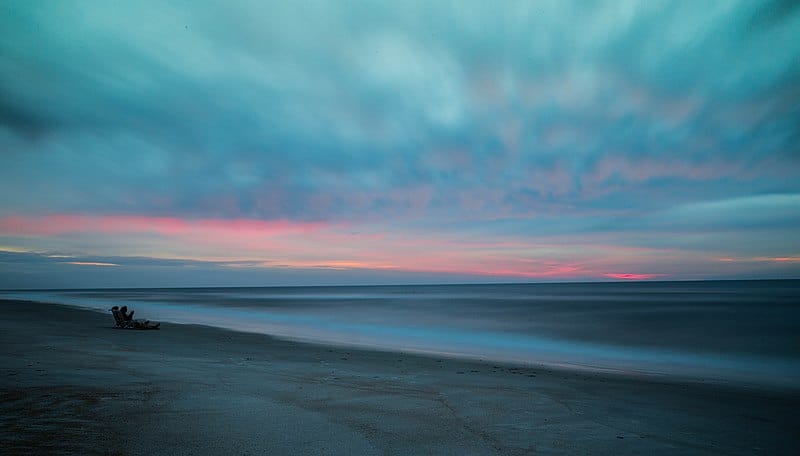
The waterway also offers boaters a scenic alternative to open-ocean sailing.
Despite its name, only a small portion of the Intercoastal Waterway is actually coastal. The vast majority of the route runs through inland waterways, including rivers, bays, and sounds.
In some places, the waterway is just a few hundred feet from shore; in others, it is several miles offshore.
The Intercoastal Waterway is one of the busiest waterways in the world. Millions of tons of cargo are transported along the route each year, and thousands of recreational boats use the waterway annually.
They still have an important place in Florida’s history and culture, but the canal houses have been removed. The canals and rivers that connect the Gulf and Atlantic coasts now serve as recreation areas.
It is the perfect spot for snowbirds to relocate and retire.
Wrapping Up…
The Intercoastal Waterway is an important part of American history and culture. It is used extensively for commerce and transportation and offers a scenic alternative to open-ocean sailing.
The waterway is maintained by the Army Corps of Engineers and is overseen by the Florida Inland Navigation District. Despite its name, only a small portion of the Intercoastal Waterway is actually coastal.
The vast majority of the route runs through inland waterways, including rivers, bays, and sounds.